Description
Geographic information systems specialists use specialised computer systems, engineering measures, and geological concepts to process land, geographic, and geospatial information into visually detailed digital maps and geomodels of a reservoir. They convert technical information like soil density and properties into digital representations for engineers, governments, and interested stakeholders.
Duties
Here are the typical duties of geographic information systems specialists:
- Collect and compile geographic data from various sources, including satellite imagery, aerial photographs, GPS surveys, field observations, and public databases. Ensure data accuracy, completeness, and relevance for GIS analysis and mapping purposes.
- Organize and maintain GIS databases, spatial datasets, and metadata in accordance with established standards and protocols. This involves creating data layers, attribute tables, and geodatabases to store and retrieve spatial information efficiently.
- Perform spatial analysis and geoprocessing tasks using GIS software to identify patterns, trends, and relationships within geographic datasets. Apply analytical techniques such as buffering, overlay analysis, proximity analysis, and spatial interpolation to solve spatial problems and support decision-making.
- Create maps, charts, and visualizations using GIS software to represent spatial data and communicate findings effectively. Customize map layouts, symbology, labels, and annotations to convey information clearly to end-users and stakeholders.
- Process and analyze remotely sensed imagery, such as satellite imagery, aerial photographs, and LiDAR data, to extract information about land cover, land use, vegetation, terrain, and environmental features. Integrate remote sensing data with GIS datasets for comprehensive spatial analysis.
- Develop and implement spatial models and algorithms to simulate and predict spatial phenomena, such as flood inundation, habitat suitability, urban growth, and transportation networks. Use GIS modeling tools to assess potential impacts and scenarios for planning and decision support.
- Query GIS databases and generate reports to extract specific information or perform data analysis tasks. Use SQL queries, attribute filters, and spatial queries to retrieve relevant data and generate summary statistics, charts, and graphs for reporting purposes.
- Customize and extend GIS functionality by developing scripts, tools, and applications using programming languages such as Python, JavaScript, or R. Create custom geoprocessing tools, web applications, and mobile apps to address unique GIS requirements and workflows.
- Conduct quality assurance and quality control (QA/QC) checks on GIS data and analysis results to ensure accuracy, consistency, and reliability. Validate data inputs, perform error detection, and document data lineage and processing steps for transparency and reproducibility.
- Provide training and technical support to GIS users, including staff members, clients, and stakeholders. Conduct workshops, tutorials, and user guides to promote GIS literacy and proficiency and assist with troubleshooting and problem-solving.
- Manage GIS projects from initiation to completion, including defining project scope, objectives, timelines, and deliverables. Coordinate with multidisciplinary teams, stakeholders, and external partners to ensure project success and alignment with organizational goals.
- Stay updated on advancements in GIS technology, data standards, and industry best practices through professional development activities, training seminars, conferences, and networking opportunities. Pursue certifications and credentials to enhance GIS skills and expertise.
Other titles
The following job titles also refer to geographic information systems specialist:
geographic information systems adviser
GIS mapping assistant
geomatics technician
GIS mapping technician
GIS technician
specialist in geographic information systems
GIS data specialist
GIS application specialist
GIS analyst
geographic information systems consultant
GIS specialist
geographic information systems expert
Working conditions
GIS specialists typically work in office environments, utilizing GIS software, computers, and related technologies to perform data analysis, mapping, and modeling tasks. Fieldwork may be required for data collection, surveying, and verification purposes, depending on the nature of the projects. The role may involve occasional travel to project sites or client locations.
Minimum qualifications
A bachelor’s degree in geography, GIS, geomatics, environmental science, computer science, or a related field is typically required for entry-level positions as a GIS specialist. Practical experience gained through internships, co-op programs, or entry-level positions in GIS or related fields is valuable. Proficiency in GIS software, spatial analysis techniques, database management, and programming languages is essential. GIS specialists may also pursue advanced degrees, certifications, or professional credentials to enhance their qualifications and career prospects. Continuous learning and staying updated on advancements in GIS technology and spatial analysis contribute to ongoing professional development as a GIS specialist.
Salary
ISCO skill level
ISCO skill level is defined as a function of the complexity and range of tasks and duties to be performed in an occupation. It is measured on a scale from 1 to 4, with 1 the lowest level and 4 the highest, by considering:
- the nature of the work performed in an occupation in relation to the characteristic tasks and duties
- the level of formal education required for competent performance of the tasks and duties involved and
- the amount of informal on-the-job training and/or previous experience in a related occupation required for competent performance of these tasks and duties.
Geographic information systems specialist is a Skill level 4 occupation.
Potential next steps
No potential next step identified on the General track track for this occupation.
Essential knowledge and skills
Essential knowledge
This knowledge should be acquired through learning to fulfill the role of geographic information systems specialist.
- Geomatics: The scientific discipline that studies gathering, storing, and processing geographic information.
- Geological mapping: The technique used to create maps that clearly illustrate the geological features and rock layers of an area that may be useful for mining projects and geological explorations.
- Surveying: The technique of determining the terrestrial or three-dimensional position of points and the distances and angles between them.
- Cartography: The study of interpreting the elements depicted in maps, the measures and technical specifications.
- Geographic information systems: The tools involved in geographical mapping and positioning, such as GPS (global positioning systems), GIS (geographical information systems), and RS (remote sensing).
- Mathematics: Mathematics is the study of topics such as quantity, structure, space, and change. It involves the identification of patterns and formulating new conjectures based on them. Mathematicians strive to prove the truth or falsity of these conjectures. There are many fields of mathematics, some of which are widely used for practical applications.
- Statistics: The study of statistical theory, methods and practices such as collection, organisation, analysis, interpretation and presentation of data. It deals with all aspects of data including the planning of data collection in terms of the design of surveys and experiments in order to forecast and plan work-related activities.
- Geography: The scientific discipline that studies the land, phenomena, characteristics and inhabitants of Earth. This field seeks to understand the natural and man-made complexities of Earth.
Essential skills and competences
These skills are necessary for the role of geographic information systems specialist.
- Collect mapping data: Collect and conserve mapping resources and mapping data.
- Execute analytical mathematical calculations: Apply mathematical methods and make use of calculation technologies in order to perform analyses and devise solutions to specific problems.
- Apply statistical analysis techniques: Use models (descriptive or inferential statistics) and techniques (data mining or machine learning) for statistical analysis and ICT tools to analyse data, uncover correlations and forecast trends.
- Use geographic information systems: Work with computer data systems such as Geographic Information Systems (GIS).
- Compile GIS-data: Gather and organise GIS-data from sources such as databases and maps.
- Process collected survey data: Analyse and interpret survey data acquired from a wide variety of sources e.g. satellite surveys, aerial photography and laser measurement systems.
- Perform surveying calculations: Perform calculations and gather technical data in order to determine earth curvature corrections, traverse adjustments and closures, level runs, azimuths, marker placements, etc.
- Apply digital mapping: Make maps by formatting compiled data into a virtual image that gives a precise representation of a specific area.
- Create thematic maps: Use various techniques such as choropleth mapping and dasymetric mapping to create thematic maps based on geospatial information, using software programmes.
- Create GIS reports: Use relevant geographic informations systems to create reports and maps based on geospatial information, using GIS software programmes.
Optional knowledge and skills
Optional knowledge
This knowledge is sometimes, but not always, required for the role of geographic information systems specialist. However, mastering this knowledge allows you to have more opportunities for career development.
- Photogrammetry: The science of taking photographs from at least two different locations in order to measure land surfaces to be represented in a map, 3D model or physical model.
- Surveying methods: Have an understanding of surveying methods, remote sensing methods and equipment.
- Topography: Graphic representation of the surface features of a place or region on a map indicating their relative positions and elevations.
- Geodesy: The scientific discipline that combines applied mathematics and earth sciences in order to measure and represent the Earth. It studies phenomena such as gravitational fields, polar motion, and tides.
- CAD software: The computer-aided design (CAD) software for creating, modifying, analysing or optimising a design.
Optional skills and competences
These skills and competences are sometimes, but not always, required for the role of geographic information systems specialist. However, mastering these skills and competences allows you to have more opportunities for career development.
- Collect geological data: Participate in the collection of geological data such as core logging, geological mapping, geochemical and geophysical surveying, digital data capture, etc.
- Conduct land surveys: Conduct surveys to determine the location and features of natural and man-made structures, on surface level as well as underground and underwater. Operate electronic distance-measuring equipment and digital measuring instruments.
- Develop geological databases: Develop geological databases in order to acquire and organise information.
- Analyse environmental data: Analyse data that interpret correlations between human activities and environmental effects.
- Write work-related reports: Compose work-related reports that support effective relationship management and a high standard of documentation and record keeping. Write and present results and conclusions in a clear and intelligible way so they are comprehensible to a non-expert audience.
- Perform image editing: Edit various types of images such as analogue and digital photographs or illustrations.
- Operate surveying instruments: Operate and adjust measuring instruments such as theodolites and prisms, and other electronic distance-measuring tools.
- Use CAD software: Use computer-aided design (CAD) systems to assist in the creation, modification, analysis, or optimisation of a design.
- Interpret geophysical data: Interpret data of a geophysical nature: Earth’s shape, its gravitational and magnetic fields, its structure and composition, and geophysical dynamics and their surface expression in plate tectonics.
- Prepare visual data: Prepare charts and graphs in order to present data in a visual manner.
- Collect data using GPS: Gather data in the field using Global Positioning System (GPS) devices.
Skills group distribution
ISCO group and title
2165 – Cartographers and surveyors
References
- Geographic information systems specialist – ESCO
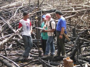
- Featured image: By USAID Indonesia – Locals using Geographic Information System, Public Domain


