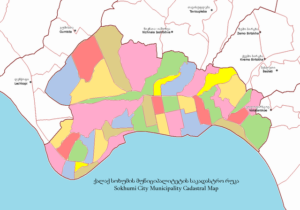
Description
Cadastral technicians design and create maps and blueprints, converting new measurement results into the real estate cadastre of a community. They define and indicate the property boundaries and ownerships, land use, and create city and district maps using measurement equipment and specialised software.
Duties
Here are some duties of cadastral technicians:
- Create and update cadastral maps and land parcel boundaries using survey data, legal descriptions, aerial imagery, and geographic information systems (GIS) software. This involves accurately representing the spatial extent and dimensions of land parcels.
- Conduct research on property deeds, surveys, land titles, and other legal documents to verify land ownership, boundaries, and rights. This includes interpreting legal descriptions, boundary agreements, and historical records.
- Analyze survey data, including metes and bounds descriptions, boundary surveys, and cadastral surveys, to determine the location and configuration of land parcels. This may involve using surveying instruments and techniques to collect and verify spatial data.
- Manage cadastral databases and land records systems, ensuring data accuracy, integrity, and accessibility. This includes organizing, cataloging, and updating cadastral information to support land administration and property taxation.
- Identify and assign unique identifiers to cadastral parcels, such as parcel numbers, tax map identifiers, or parcel identification numbers (PINs), to facilitate property taxation, land registration, and administrative processes.
- Assist in resolving boundary disputes and discrepancies through field surveys, legal analysis, and consultation with landowners, surveyors, and legal professionals. This may involve preparing exhibits, affidavits, and survey plats for legal proceedings.
- Ensure the accuracy and consistency of cadastral data and maps through rigorous quality control measures. This includes reviewing survey data, field notes, and legal documents for completeness and compliance with standards and regulations.
- Ensure compliance with government regulations, standards, and policies governing cadastral mapping, land registration, and property taxation. This includes following surveying standards, cadastral mapping guidelines, and data-sharing protocols.
- Provide information and assistance to landowners, developers, government agencies, and the general public regarding cadastral maps, land records, and property ownership. This may involve responding to inquiries, providing technical support, and conducting public meetings or workshops.
- Utilize geographic information systems (GIS), global positioning systems (GPS), remote sensing technologies, and cadastral software tools to enhance cadastral mapping and land records management processes. This includes integrating spatial data from various sources to create comprehensive cadastral databases.
- Provide training and education to staff, surveyors, land administrators, and other stakeholders on cadastral mapping techniques, land registration procedures, and cadastral data management practices. This promotes consistency and proficiency in cadastral operations.
- Stay updated on advancements in cadastral mapping technology, surveying methods, and land administration practices through professional development activities, training seminars, and participation in professional organizations.
Sign in to contribute to the Duties section
Other titles
The following job titles also refer to cadastral technician:
cadastral land surveyor
cadastral mapping technician
land agent
cadastral surveyor
Working conditions
Cadastral technicians typically work in office settings, utilizing computer software and GIS tools to create and analyze cadastral maps and land records. Fieldwork may be required for surveying, data collection, and boundary verification purposes, depending on the nature of the projects. The role may involve occasional travel to project sites or meetings with stakeholders.
Sign in to contribute to the Working conditions section
Minimum qualifications
A bachelor’s degree in surveying, geography, GIS, land administration, or a related field is typically required for entry-level positions as a cadastral technician. Practical experience gained through internships, co-op programs, or entry-level positions in cadastral mapping or land surveying is valuable. Proficiency in GIS software, surveying techniques, legal research, and cadastral principles is essential. Continuous learning and staying updated on advancements in cadastral mapping technology and land administration practices contribute to ongoing professional development as a cadastral technician.
Sign in to contribute to the Minimum qualifications section
Salary
Sign in to contribute to the Salary section
ISCO skill level
ISCO skill level is defined as a function of the complexity and range of tasks and duties to be performed in an occupation. It is measured on a scale from 1 to 4, with 1 the lowest level and 4 the highest, by considering:
- the nature of the work performed in an occupation in relation to the characteristic tasks and duties
- the level of formal education required for competent performance of the tasks and duties involved and
- the amount of informal on-the-job training and/or previous experience in a related occupation required for competent performance of these tasks and duties.
Cadastral technician is a Skill level 4 occupation.
Potential next steps
No potential next step identified on the General track track for this occupation.
How to get here
Essential knowledge and skills
Essential knowledge
This knowledge should be acquired through learning to fulfill the role of cadastral technician.
- Cartography: The study of interpreting the elements depicted in maps, the measures and technical specifications.
- Geographic information systems: The tools involved in geographical mapping and positioning, such as GPS (global positioning systems), GIS (geographical information systems), and RS (remote sensing).
- Surveying methods: Have an understanding of surveying methods, remote sensing methods and equipment.
Essential skills and competences
These skills are necessary for the role of cadastral technician.
- Record survey measurements: Gather and process descriptive data by using documents such as sketches, drawings and notes.
- Conduct land surveys: Conduct surveys to determine the location and features of natural and man-made structures, on surface level as well as underground and underwater. Operate electronic distance-measuring equipment and digital measuring instruments.
- Use geographic information systems: Work with computer data systems such as Geographic Information Systems (GIS).
- Document survey operations: Complete and file all required administrative, operational and technical documents related to a survey operation.
- Process collected survey data: Analyse and interpret survey data acquired from a wide variety of sources e.g. satellite surveys, aerial photography and laser measurement systems.
- Perform surveying calculations: Perform calculations and gather technical data in order to determine earth curvature corrections, traverse adjustments and closures, level runs, azimuths, marker placements, etc.
- Operate surveying instruments: Operate and adjust measuring instruments such as theodolites and prisms, and other electronic distance-measuring tools.
- Compare survey computations: Determine the accuracy of data by comparing computations with applicable standards.
- Create cadastral maps: Create maps using data gathered during surveying and measurement activities and specialised software which outline a region’s constructions’ and buildings’ boundaries.
Optional knowledge and skills
Optional knowledge
This knowledge is sometimes, but not always, required for the role of cadastral technician. However, mastering this knowledge allows you to have more opportunities for career development.
- Construction legal systems: The different legal systems and regulations governing construction activities across Europe.
- Visual presentation techniques: The visual representation and interaction techniques, such as histograms, scatter plots, surface plots, tree maps and parallel coordinate plots, that can be used to present abstract numerical and non-numerical data, in order to reinforce the human understanding of this information.
- Quality standards: The national and international requirements, specifications and guidelines to ensure that products, services and processes are of good quality and fit for purpose.
- CAD software: The computer-aided design (CAD) software for creating, modifying, analysing or optimising a design.
- Concurrent estate: The concept in property law which stipulates the rights and duties of two parties co-owning a property, and the various ways in which co-tenancy is possible.
Optional skills and competences
These skills and competences are sometimes, but not always, required for the role of cadastral technician. However, mastering these skills and competences allows you to have more opportunities for career development.
- Manage cadastre: Manage the register of the real estate and real property’s metes-and-bounts of a community using cadastral surveys or cadastral maps.
- Use data processing techniques: Gather, process and analyse relevant data and information, properly store and update data and represent figures and data using charts and statistical diagrams.
- Comply with legal regulations: Ensure you are properly informed of the legal regulations that govern a specific activity and adhere to its rules, policies and laws.
- Respond to enquiries: Respond to enquiries and requests for information from other organisations and members of the public.
- Operate GPS systems: Use GPS Systems.
- Use CAD software: Use computer-aided design (CAD) systems to assist in the creation, modification, analysis, or optimisation of a design.
- Deliver visual presentation of data: Create visual representations of data such as charts or diagrams for easier understanding.
- Collect data using GPS: Gather data in the field using Global Positioning System (GPS) devices.
- Review construction plans authorisations: Review plans for conformance to codes and authorised approval for construction.
Skills group distribution
ISCO group and title
2165 – Cartographers and surveyors
References
- Cadastral technician – ESCO
- Featured image: By Abkhazian1 – Own work, CC BY-SA 4.0