Description
Geology technicians assist in all the activities carried out by geologists. They, under the supervision of geologists, collect materials, carry out research and study the samples collected from the Earth in order to offer analysis as part of the project and the aim. Geology technicians assist in determining the value of the land for oil or gas exploration. They perform various technical tasks, including collecting samples during geochemical surveys, working on drill sites, and participating in geophysical surveys and geological studies.
Duties
Geology technicians typically do the following duties:
- Collect and analyze samples, for example, rock, soil, and core samples.
- Extract and interpret geological information from aerial photographs, satellite images, contour maps, and cross-sections.
- Process and interpret geophysical data acquired using gravitational, magnetic, electromagnetic, seismic, and other remote sensing methods.
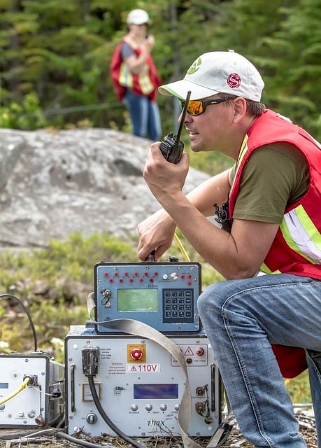
- Operate and maintain geophysical survey and well-logging instruments and equipment.
- Conduct geophysical surveys for locating environmental problems, for example, contaminant plumes and buried hazardous waste mapping.
- Maintain geological and geophysical databases.
- Analyze core samples from drilling sites.
- Interpret hydrogeological maps, reports, and studies.
Geology technicians work on teams under the supervision of scientists and engineers. They help with tasks such as exploring and developing prospective sites or monitoring the productivity of existing ones.
Geology technicians also might work with scientists and technicians of other disciplines. For example, these technicians may work with environmental scientists and technicians to identify the potential impacts of drilling on an area’s soil and water quality.
Sign in to contribute to the Duties section
Other titles
The following job titles also refer to geology technician:
geological engineering technician
geological technician
geoscience technician
material sampler
geophysical data technician
mineral industry sampler
mineral technician
mine production techician
geophysical technician
geo-mechanics technician
geological and petroleum technician
geo-technician
mining technician
geological survey technician
geologist
minerals survey technician
mine surveying technician
mineralogy technician
Working conditions
Geology technicians work either in fields and laboratories or in offices. Fieldwork requires technicians to be outdoors, sometimes in remote locations, where they are exposed to all types of weather. In addition, technicians may need to stay on location for days or weeks to collect data and monitor equipment.
Geology technicians who work in offices spend most of their time on computers to organize and analyze data, write reports, and produce maps.
Most geology technicians work full time. Technicians generally work standard hours in laboratories and offices but may have irregular schedules in the field.
Sign in to contribute to the Working conditions section
Minimum qualifications
Although entry-level positions typically require an associate’s degree in applied science or a science-related technology, employers may prefer to hire applicants who have a bachelor’s degree. Geology technician jobs that are data intensive or highly technical may require a bachelor’s degree.
Community colleges and technical institutes may offer programs in geosciences, mining, or a related subject, such as geographic information systems (GIS). Regardless of the program, most students take courses in geology, mathematics, computer science, chemistry, and physics. Schools also may offer internships and cooperative-education programs in which students gain experience while attending school.
Sign in to contribute to the Minimum qualifications section
Salary
Sign in to contribute to the Salary section
ISCO skill level
ISCO skill level is defined as a function of the complexity and range of tasks and duties to be performed in an occupation. It is measured on a scale from 1 to 4, with 1 the lowest level and 4 the highest, by considering:
- the nature of the work performed in an occupation in relation to the characteristic tasks and duties
- the level of formal education required for competent performance of the tasks and duties involved and
- the amount of informal on-the-job training and/or previous experience in a related occupation required for competent performance of these tasks and duties.
Geology technician is a Skill level 3 occupation.
Potential next steps
No potential next step identified on the General track track for this occupation.
No potential next step identified on the Manager track track for this occupation.
How to get here
Essential knowledge and skills
Essential knowledge
This knowledge should be acquired through learning to fulfill the role of geology technician.
- Cartography: The study of interpreting the elements depicted in maps, the measures and technical specifications.
- Mathematics: Mathematics is the study of topics such as quantity, structure, space, and change. It involves the identification of patterns and formulating new conjectures based on them. Mathematicians strive to prove the truth or falsity of these conjectures. There are many fields of mathematics, some of which are widely used for practical applications.
- Geological time scale: System of chronological measurement dividing geologic history into several temporal divisions and subdivisions that take ancient life, geography, and climates into account.
- Statistics: The study of statistical theory, methods and practices such as collection, organisation, analysis, interpretation and presentation of data. It deals with all aspects of data including the planning of data collection in terms of the design of surveys and experiments in order to forecast and plan work-related activities.
- Scientific research methodology: The theoretical methodology used in scientific research involving doing background research, constructing an hypothesis, testing it, analysing data and concluding the results.
Essential skills and competences
These skills are necessary for the role of geology technician.
- Work ergonomically: Apply ergonomy principles in the organisation of the workplace while manually handling equipment and materials.
- Collect geological data: Participate in the collection of geological data such as core logging, geological mapping, geochemical and geophysical surveying, digital data capture, etc.
- Collect samples: Set up and operate equipment to collect water, gas or soil samples for testing.
- Execute analytical mathematical calculations: Apply mathematical methods and make use of calculation technologies in order to perform analyses and devise solutions to specific problems.
- Record test data: Record data which has been identified specifically during preceding tests in order to verify that outputs of the test produce specific results or to review the reaction of the subject under exceptional or unusual input.
- Apply statistical analysis techniques: Use models (descriptive or inferential statistics) and techniques (data mining or machine learning) for statistical analysis and ICT tools to analyse data, uncover correlations and forecast trends.
- Collect samples for analysis: Collect samples of materials or products for laboratory analysis.
- Apply safety procedures in laboratory: Make sure that laboratory equipment is used in a safe manner and the handling of samples and specimens is correct. Work to ensure the validity of results obtained in research.
- Apply scientific methods: Apply scientific methods and techniques to investigate phenomena, by acquiring new knowledge or correcting and integrating previous knowledge.
- Write production reports: Make up and complete shift schedules and production reports in a timely manner.
- Prepare technical reports: Prepare technical reports that describe results and processes of scientific or technical research, or assess its progress. These reports help researchers to keep up to date with recent findings.
- Perform sample testing: Examine and perform tests on prepared samples; avoid any possibility of accidental or deliberate contamination during the testing phase. Operate sampling equipment in line with design parameters.
- Conduct field work: Conduct field work or research which is the collection of information outside of a laboratory or workplace setting. Visit places in order to collect specific information about the field.
- Operate scientific measuring equipment: Operate devices, machinery, and equipment designed for scientific measurement. Scientific equipment consists of specialised measuring instruments refined to facilitate the acquisition of data.
- Prepare samples for testing: Take and prepare samples for testing, verify their representability; avoid bias and any possibility of accidental or deliberate contamination. Provide clear numbering, labelling and recording of the sample details, in order to make sure that the results can be accurately matched to the original material.
- Assist scientific research: Assist engineers or scientists with conducting experiments, performing analysis, developing new products or processes, constructing theory, and quality control.
- Test raw minerals: Take samples of mineral materials for testing purposes. Execute various chemical and physical tests on the materials.
Optional knowledge and skills
Optional knowledge
This knowledge is sometimes, but not always, required for the role of geology technician. However, mastering this knowledge allows you to have more opportunities for career development.
- Geographic information systems: The tools involved in geographical mapping and positioning, such as GPS (global positioning systems), GIS (geographical information systems), and RS (remote sensing).
- Physics: The natural science involving the study of matter, motion, energy, force and related notions.
- Environmental legislation: The environmental policies and legislation applicable in a certain domain.
- Geochemistry: The scientific discipline that studies the presence and distribution of chemical elements in the geological systems of Earth.
- Geodesy: The scientific discipline that combines applied mathematics and earth sciences in order to measure and represent the Earth. It studies phenomena such as gravitational fields, polar motion, and tides.
- Geophysics: The scientific field that deals with the physical processes and properties of, and spatial environment surrounding Earth. Geophysics also deals with the quantitative analysis of phenomena such as magnetic fields, the internal structure of Earth, and its hydrological cycle.
- Geology: Solid earth, rock types, structures and the processes by which they are altered.
Optional skills and competences
These skills and competences are sometimes, but not always, required for the role of geology technician. However, mastering these skills and competences allows you to have more opportunities for career development.
- Assist with geophysical surveys: Assist with a range of specific, geophysical surveys, using diverse methods such as seismic, magnetic and electromagnetic methods.
- Perform laboratory tests: Carry out tests in a laboratory to produce reliable and precise data to support scientific research and product testing.
- Use a computer: Utilise computer equipment or digital devices to facilitate quality control, data management, and communication. Follow instructions given by a computer programme, create computer files or documents.
- Prepare surveying report: Write a survey report containing information on property boundaries, the height and depth of the terrain, etc..
- Maintain cores: Clean and repair cores, e.g. by smoothing out imperfections on the surface.
- Troubleshoot: Identify operating problems, decide what to do about it and report accordingly.
- Use geographic information systems: Work with computer data systems such as Geographic Information Systems (GIS).
- Liaise with geology professionals: Establish relationships with commercial managers, geologists and petroleum engineers.
- Develop geological databases: Develop geological databases in order to acquire and organise information.
- Study aerial photos: Use aerial photos to study phenomena on Earth’s surface.
- Apply digital mapping: Make maps by formatting compiled data into a virtual image that gives a precise representation of a specific area.
- Create thematic maps: Use various techniques such as choropleth mapping and dasymetric mapping to create thematic maps based on geospatial information, using software programmes.
- Conduct soil sample tests: Analyse and test soil samples; determine gas chromatography and gather relevant isotope and carbon information; determine viscosity.
- Negotiate land access: Negotiate with landowners, tenants, mineral rights owners, regulatory bodies or other stakeholders to obtain permission to access areas of interest for exploration or sampling.
- Archive scientific documentation: Store documents such as protocols, analysis results and scientific data using archiving systems to enable scientists and engineers to take methods and results from previous studies into account for their research.
- Interpret geophysical data: Interpret data of a geophysical nature: Earth’s shape, its gravitational and magnetic fields, its structure and composition, and geophysical dynamics and their surface expression in plate tectonics.
- Create GIS reports: Use relevant geographic informations systems to create reports and maps based on geospatial information, using GIS software programmes.
- Provide technical expertise: Provide expert knowledge in a particular field, especially concerning mechanical or scientific subjects, to decision makers, engineers, technical staff or journalists.
- Collect data using gps: Gather data in the field using Global Positioning System (GPS) devices.
- Provide information on geological characteristics: Provide information on geological structures, host rock quality, groundwater implications and details on the mineralogical and textural composition of ores to enable mining and processing to be planned efficiently. The geological model is used to design the mine workings for minimum dilution and maximum ore extraction.
- Assess environmental impact: Monitor environmental impacts and carry out assessments in order to identify and to reduce the organisation’s environmental risks while taking costs into account.
- Train employees: Lead and guide employees through a process in which they are taught the necessary skills for the perspective job. Organise activities aimed at introducing the work and systems or improving the performance of individuals and groups in organisational settings.
- Advise on geology for mineral extraction: Provide advice of the impact of geological factors on the development of mineral production. Take into account factors such as cost, safety, and characteristics of deposits.
- Plan geotechnical investigations in the field: Conduct thorough field investigations; perform drills and analyse samples of rocks and sediments.
- Process data: Enter information into a data storage and data retrieval system via processes such as scanning, manual keying or electronic data transfer in order to process large amounts of data.
- Investigate soil stability: Collect soil samples from the railway site, using bores and test pits in order to determine ground stress capability and stability.
- Prepare geological map sections: Prepare geological sections, a vertical view of the local geology.
Skills group distribution
ISCO group and title
3111 – Chemical and physical science technicians
References
- Geology technician – ESCO
- Geological and Hydrologic Technicians : Occupational Outlook Handbook – U.S. Bureau of Labor Statistics
- Geological and Geophysical Technician | ECO Canada
- Featured image: Image by KEVIN PALMER from Pixabay