Description
Cartographers create maps by combining various scientific information depending on the purpose of the map (e.g., topographic, urban, or political maps). They combine the interpretation of mathematical notes and measurements with the aesthetics and visual depiction of the site to develop the maps. They may also work on developing and improving geographic information systems and perform scientific research within cartography.
Duties
Typical duties of cartographers are to:
- Gather geographical data from various sources, including satellite imagery, aerial photographs, surveys, and field measurements. This may involve utilizing GPS technology and remote sensing techniques to collect accurate location information.
- Design maps and charts that effectively communicate spatial information to users. This includes selecting appropriate map projections, scales, symbols, colors, and labeling conventions to convey information clearly and accurately.
- Analyze geographical data using GIS software and analytical techniques to identify patterns, trends, and relationships. This may involve spatial analysis, terrain modeling, proximity analysis, and statistical analysis of spatial data sets.
- Produce high-quality maps and atlases for various purposes, including navigation, land use planning, environmental monitoring, and scientific research. This may involve digital map production using GIS software or traditional cartographic techniques.
- Create customized maps and spatial data products tailored to specific user requirements. This may involve integrating multiple data layers, creating thematic maps, and incorporating text annotations and graphical elements.
- Ensure cartographic products’ accuracy, completeness, and quality through rigorous review and validation processes. This may involve verifying data sources, checking for errors, and conducting peer review of maps and GIS datasets.
- Update maps and GIS databases to reflect geographical features, land use, infrastructure, and other spatial data changes. This may involve incorporating new data sources, correcting errors, and maintaining version control of map revisions.
- Collaborate with other professionals, including geographers, surveyors, urban planners, and environmental scientists, to support interdisciplinary projects and address spatial data needs.
- Conduct research on cartographic methods, techniques, and technologies to innovate and improve cartographic products and practices. This may involve studying new mapping tools, exploring visualization techniques, and evaluating map design principles.
- Provide support and training to users of cartographic products and GIS systems. This may involve assisting with map interpretation, data analysis, and software usage to facilitate informed decision-making.
- Create maps and spatial data products for environmental assessment, conservation planning, and natural resource management. This may involve mapping habitat distribution, land cover change, and environmental impacts.
- Communicate spatial information effectively to a diverse audience, including policymakers, stakeholders, and the general public. This may involve presenting maps and GIS analyses in reports, presentations, and interactive web applications.
Sign in to contribute to the Duties section
Other titles
The following job titles also refer to cartographer:
cartographic draftsperson
cartographic science researcher
cartographic analyst
cartographic drafter
cartographic research analyst
map maker
cartographic research scientist
cartographic researcher
cartographic scientist
cartographers
Working conditions
Cartographers typically work in office environments, utilizing computer software and GIS tools to create and analyze spatial data. Fieldwork may be required for data collection, surveying, and validation purposes, depending on the nature of the projects. The role may involve occasional travel to project sites or client locations.
Sign in to contribute to the Working conditions section
Minimum qualifications
A bachelor’s degree in geography, cartography, GIS, surveying, or a related field is typically required for entry-level positions as a cartographer. Advanced degrees, such as a master’s or Ph.D., may be required for research or specialized roles. Proficiency in GIS software, remote sensing techniques, and cartographic principles is essential. Practical experience gained through internships, co-op programs, or entry-level positions in cartography or GIS is valuable. Continuous learning and staying updated on advancements in GIS technology and spatial analysis contribute to ongoing professional development as a cartographer.
Sign in to contribute to the Minimum qualifications section
Salary
Sign in to contribute to the Salary section
ISCO skill level
ISCO skill level is defined as a function of the complexity and range of tasks and duties to be performed in an occupation. It is measured on a scale from 1 to 4, with 1 the lowest level and 4 the highest, by considering:
- the nature of the work performed in an occupation in relation to the characteristic tasks and duties
- the level of formal education required for competent performance of the tasks and duties involved and
- the amount of informal on-the-job training and/or previous experience in a related occupation required for competent performance of these tasks and duties.
Cartographer is a Skill level 4 occupation.
Potential next steps
No potential next step identified on the General track track for this occupation.
How to get here
Occupations that commonly lead to this role, based on skill overlap and career proximity.
Expert track
These occupations build toward the deeper specialisation required for this role.
- land surveyorMatch: 37%
- hydrographic surveyorMatch: 47%
Essential knowledge and skills
Essential knowledge
This knowledge should be acquired through learning to fulfill the role of cartographer.
- Geomatics: The scientific discipline that studies gathering, storing, and processing geographic information.
- Cartography: The study of interpreting the elements depicted in maps, the measures and technical specifications.
- Geographic information systems: The tools involved in geographical mapping and positioning, such as GPS (global positioning systems), GIS (geographical information systems), and RS (remote sensing).
- Mathematics: Mathematics is the study of topics such as quantity, structure, space, and change. It involves the identification of patterns and formulating new conjectures based on them. Mathematicians strive to prove the truth or falsity of these conjectures. There are many fields of mathematics, some of which are widely used for practical applications.
- Topography: Graphic representation of the surface features of a place or region on a map indicating their relative positions and elevations.
- Geography: The scientific discipline that studies the land, phenomena, characteristics and inhabitants of Earth. This field seeks to understand the natural and man-made complexities of Earth.
Essential skills and competences
These skills are necessary for the role of cartographer.
- Collect mapping data: Collect and conserve mapping resources and mapping data.
- Execute analytical mathematical calculations: Apply mathematical methods and use calculation technologies to perform analyses and devise solutions to specific problems.
- Use geographic information systems: Work with computer data systems such as Geographic Information Systems (GIS).
- Compile GIS-data: Gather and organise GIS-data from sources such as databases and maps.
- Handle geospatial technologies: Use geospatial technologies which involve GPS (global positioning systems), GIS (geographical information systems), and RS (remote sensing) in the daily work.
- Draft legends: Draft explanatory texts, tables or lists of symbols to make products such as maps and charts more accessible to users.
- Improve user-friendliness: Research and test new methods to make a product such as a website or map easier to use and understand.
- Apply digital mapping: Make maps by formatting compiled data into a virtual image that gives a precise representation of a specific area.
- Create thematic maps: Use various techniques such as choropleth mapping and dasymetric mapping to create thematic maps based on geospatial information, using software programmes.
- Create GIS reports: Use relevant geographic informations systems to create reports and maps based on geospatial information, using GIS software programmes.
Optional knowledge and skills
Optional knowledge
This knowledge is sometimes, but not always, required for the role of cartographer. However, mastering this knowledge allows you to have more opportunities for career development.
- Photogrammetry: The science of taking photographs from at least two different locations in order to measure land surfaces to be represented in a map, 3D model or physical model.
- Surveying: The technique of determining the terrestrial or three-dimensional position of points and the distances and angles between them.
- Surveying methods: Have an understanding of surveying methods, remote sensing methods and equipment.
- Geodesy: The scientific discipline that combines applied mathematics and earth sciences in order to measure and represent the Earth. It studies phenomena such as gravitational fields, polar motion, and tides.
- Geology: Solid earth, rock types, structures and the processes by which they are altered.
- Legal research: The methods and procedures of research in legal matters, such as the regulations, and different approaches to analyses and source gathering, and the knowledge on how to adapt the research methodology to a specific case to obtain the required information.
- ICT system programming: The methods and tools required to develop system software, specifications of system architectures and interfacing techniques between network and system modules and components.
- Desktop publishing: The creation of documents using page layout skills on a computer. Desktop publishing software can generate layouts and produce typographic quality text and images.
- Remote sensing techniques: The different techniques to obtain information on objects and phenomena on Earth’s surface without having physical contact with them, such as electromagnetic radiation, radar imaging, and sonar imaging.
- Scientific research methodology: The theoretical methodology used in scientific research involving doing background research, constructing an hypothesis, testing it, analysing data and concluding the results.
Optional skills and competences
These skills and competences are sometimes, but not always, required for the role of cartographer. However, mastering these skills and competences allows you to have more opportunities for career development.
- Use traditional illustration techniques: Create drawings using traditional illustration techniques such as watercolour, pen and ink, airbrush art, oil painting, pastels, wood engraving, and linoleum cuts.
- Design customised maps: Design maps taking into account the customer’s specifications and requirements.
- Use software for data preservation: Utilise specialised applications and software to collect and preserve digital information.
- Conduct scholarly research: Plan scholarly research by formulating the research question and conducting empirical or literature research in order to investigate the truth of the research question.
- Apply desktop publishing techniques: Apply desktop publishing techniques and software to create page layouts and typographic-quality text.
- Perform scientific research: Gain, correct or improve knowledge about phenomena by using scientific methods and techniques, based on empirical or measurable observations.
- Identify customer’s needs: Use appropriate questions and active listening in order to identify customer expectations, desires and requirements according to product and services.
- Process collected survey data: Analyse and interpret survey data acquired from a wide variety of sources e.g. satellite surveys, aerial photography and laser measurement systems.
- Study aerial photos: Use aerial photos to study phenomena on Earth’s surface.
- Conduct quantitative research: Execute a systematic empirical investigation of observable phenomena via statistical, mathematical or computational techniques.
- Perform surveying calculations: Perform calculations and gather technical data in order to determine earth curvature corrections, traverse adjustments and closures, level runs, azimuths, marker placements, etc.
- Use digital illustration techniques: Create drawings using digital illustration programmes and techniques.
- Archive scientific documentation: Store documents such as protocols, analysis results and scientific data using archiving systems to enable scientists and engineers to take methods and results from previous studies into account for their research.
- Use CAD software: Use computer-aided design (CAD) systems to assist in the creation, modification, analysis, or optimisation of a design.
- Conduct field work: Conduct field work or research which is the collection of information outside of a laboratory or workplace setting. Visit places in order to collect specific information about the field.
- Report analysis results: Produce research documents or give presentations to report the results of a conducted research and analysis project, indicating the analysis procedures and methods which led to the results, as well as potential interpretations of the results.
- Operate scientific measuring equipment: Operate devices, machinery, and equipment designed for scientific measurement. Scientific equipment consists of specialised measuring instruments refined to facilitate the acquisition of data.
- Assist scientific research: Assist engineers or scientists with conducting experiments, performing analysis, developing new products or processes, constructing theory, and quality control.
- Collect data using gps: Gather data in the field using Global Positioning System (GPS) devices.
- Design graphics: Apply a variety of visual techniques in order to design graphic material. Combine graphical elements to communicate concepts and ideas.
Skills group distribution
ISCO group and title
2165 – Cartographers and surveyors
References
- Cartographer – ESCO
- Cartographer – ECO Canada
- How to Become a Cartographer in 6 Steps | Indeed.com
- What does a cartographer do? – CareerExplorer
- Cartographer job profile | Prospects.ac.uk
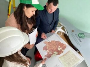
- Featured image: By Насртдинова Ю.Р. – Own work, CC BY 4.0