Description
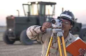
Land surveyors determine, by means of specialised equipment, the distances and positions of points at the surface of sites for construction purposes. They use measurements of the specific aspects of construction sites, such as electricity, distance measurements, and metal structure volumes to create architectural drawings and develop construction projects.
Duties
Here are some typical duties of land surveyors:
- Conduct boundary surveys to determine and demarcate property lines, easements, and rights-of-way. This involves using surveying instruments and techniques to measure angles, distances, and elevation changes along property boundaries.
- Perform topographic surveys to map the natural and man-made features of a site, including contours, vegetation, structures, utilities, and terrain variations. This information is used for land development, engineering design, and environmental assessment purposes.
- Provide construction layout services to guide the placement of buildings, roads, utilities, and infrastructure elements according to design plans and specifications. This involves staking out reference points, benchmarks, and alignment marks on the ground.
- Conduct ALTA/NSPS land title surveys to provide detailed information on property boundaries, easements, encroachments, and land use restrictions for real estate transactions and property development projects.
- Perform subdivision surveys to divide larger parcels of land into smaller lots or parcels for development or sale. Ensure compliance with subdivision regulations, zoning ordinances, and planning requirements.
- Prepare legal descriptions and plat maps that accurately define the boundaries, dimensions, and locations of land parcels in accordance with legal standards and surveying principles. These descriptions are used for property deeds, land records, and title documents.
- Issue elevation certificates to document the elevation of buildings and structures relative to flood hazard areas for insurance purposes and regulatory compliance.
- Utilize GPS technology to conduct surveys for large-scale mapping projects, geodetic control networks, and geospatial data collection. This allows for high-precision positioning and mapping over large areas.
- Process survey data using specialized software and GIS tools to generate accurate maps, digital terrain models (DTMs), and survey reports. Verify data accuracy and consistency through rigorous quality control procedures.
- Assist in resolving boundary disputes and property line conflicts through surveying evidence, legal research, and expert testimony. Provide surveying expertise and documentation to support legal proceedings and property negotiations.
- Ensure compliance with surveying standards, regulations, and ethical guidelines established by professional organizations and government agencies. Adhere to industry best practices and maintain professional integrity in surveying operations.
- Communicate with clients, landowners, developers, engineers, and other stakeholders to understand project requirements, provide technical advice, and address concerns related to surveying and land management issues.
Sign in to contribute to the Duties section
Other titles
The following job titles also refer to land surveyor:
geomatics surveyor
surveying engineer
surveyor
surveyors
Working conditions
Land surveyors work in both field and office environments, splitting their time between outdoor surveying activities and office-based tasks such as data processing, analysis, and reporting. Fieldwork may involve working in diverse terrain and weather conditions, using surveying instruments and equipment to collect accurate measurements and observations.
Sign in to contribute to the Working conditions section
Minimum qualifications
A bachelor’s degree in surveying, geomatics, civil engineering, or a related field is typically required for entry-level positions as a land surveyor. Practical experience gained through internships, co-op programs, or entry-level positions in surveying or construction is valuable. Proficiency in surveying instruments, CAD software, and GIS tools is essential. Land surveyors may also require licensure or certification, depending on jurisdictional requirements. Continuous learning and staying updated on advancements in surveying technology and land surveying practices contribute to ongoing professional development as a land surveyor.
Sign in to contribute to the Minimum qualifications section
Salary
Sign in to contribute to the Salary section
ISCO skill level
ISCO skill level is defined as a function of the complexity and range of tasks and duties to be performed in an occupation. It is measured on a scale from 1 to 4, with 1 the lowest level and 4 the highest, by considering:
- the nature of the work performed in an occupation in relation to the characteristic tasks and duties
- the level of formal education required for competent performance of the tasks and duties involved and
- the amount of informal on-the-job training and/or previous experience in a related occupation required for competent performance of these tasks and duties.
Land surveyor is a Skill level 4 occupation.
Potential next steps
No potential next step identified on the General track track for this occupation.
How to get here
Occupations that commonly lead to this role, based on skill overlap and career proximity.
Expert track
These occupations build toward the deeper specialisation required for this role.
- cadastral technicianMatch: 84%
- hydrographic surveyorMatch: 80%
- cartographerMatch: 61%
Essential knowledge and skills
Essential knowledge
This knowledge should be acquired through learning to fulfill the role of land surveyor.
- Geomatics: The scientific discipline that studies gathering, storing, and processing geographic information.
- Surveying: The technique of determining the terrestrial or three-dimensional position of points and the distances and angles between them.
- Engineering principles: The engineering elements like functionality, replicability, and costs in relation to the design and how they are applied in the completion of engineering projects.
- Cartography: The study of interpreting the elements depicted in maps, the measures and technical specifications.
- Mathematics: Mathematics is the study of topics such as quantity, structure, space, and change. It involves the identification of patterns and formulating new conjectures based on them. Mathematicians strive to prove the truth or falsity of these conjectures. There are many fields of mathematics, some of which are widely used for practical applications.
- Technical drawings: Drawing software and the various symbols, perspectives, units of measurement, notation systems, visual styles and page layouts used in technical drawings.
- Surveying methods: Have an understanding of surveying methods, remote sensing methods and equipment.
- Engineering processes: The systematic approach to the development and maintenance of engineering systems.
- Topography: Graphic representation of the surface features of a place or region on a map indicating their relative positions and elevations.
- Geodesy: The scientific discipline that combines applied mathematics and earth sciences in order to measure and represent the Earth. It studies phenomena such as gravitational fields, polar motion, and tides.
- Civil engineering: The engineering discipline that studies the design, construction and maintenance of naturally built works such as roads, buildings, and canals.
- Mining, construction and civil engineering machinery products: The offered mining, construction and civil engineering machinery products, their functionalities, properties and legal and regulatory requirements.
Essential skills and competences
These skills are necessary for the role of land surveyor.
- Record survey measurements: Gather and process descriptive data by using documents such as sketches, drawings and notes.
- Prepare surveying report: Write a survey report containing information on property boundaries, the height and depth of the terrain, etc..
- Ensure compliance with safety legislation: Implement safety programmes to comply with national laws and legislation. Ensure that equipment and processes are compliant with safety regulations.
- Conduct land surveys: Conduct surveys to determine the location and features of natural and man-made structures, on surface level as well as underground and underwater. Operate electronic distance-measuring equipment and digital measuring instruments.
- Adjust engineering designs: Adjust designs of products or parts of products so that they meet requirements.
- Perform scientific research: Gain, correct or improve knowledge about phenomena by using scientific methods and techniques, based on empirical or measurable observations.
- Use technical drawing software: Create technical designs and technical drawings using specialised software.
- Document survey operations: Complete and file all required administrative, operational and technical documents related to a survey operation.
- Perform surveying calculations: Perform calculations and gather technical data in order to determine earth curvature corrections, traverse adjustments and closures, level runs, azimuths, marker placements, etc.
- Calibrate electronic instruments: Correct and adjust the reliability of an electronic instrument by measuring output and comparing results with the data of a reference device or a set of standardised results. This is done in regular intervals which are set by the manufacturer and using calibration devices.
- Determine boundaries: Establish the boundaries of properties using surveying equipment.
- Operate surveying instruments: Operate and adjust measuring instruments such as theodolites and prisms, and other electronic distance-measuring tools.
- Adjust surveying equipment: Ensure accuracy of measurement by adjusting surveying equipment.
- Compare survey computations: Determine the accuracy of data by comparing computations with applicable standards.
- Approve engineering design: Give consent to the finished engineering design to go over to the actual manufacturing and assembly of the product.
Optional knowledge and skills
Optional knowledge
This knowledge is sometimes, but not always, required for the role of land surveyor. However, mastering this knowledge allows you to have more opportunities for career development.
- Photogrammetry: The science of taking photographs from at least two different locations in order to measure land surfaces to be represented in a map, 3D model or physical model.
- Urban planning law: Investments and urban development agreements. Legislative developments regarding construction in terms of environmental, sustainability, social and financial matters.
- Geographic information systems: The tools involved in geographical mapping and positioning, such as GPS (global positioning systems), GIS (geographical information systems), and RS (remote sensing).
- Geology: Solid earth, rock types, structures and the processes by which they are altered.
- Geography: The scientific discipline that studies the land, phenomena, characteristics and inhabitants of Earth. This field seeks to understand the natural and man-made complexities of Earth.
Optional skills and competences
These skills and competences are sometimes, but not always, required for the role of land surveyor. However, mastering these skills and competences allows you to have more opportunities for career development.
- Advise on mining environmental issues: Collaborate with engineers, surveyors, geotechnical staff and metallurgists, involved in environmental protection and land rehabilitation after mining activities.
- Collect geological data: Participate in the collection of geological data such as core logging, geological mapping, geochemical and geophysical surveying, digital data capture, etc.
- Collect mapping data: Collect and conserve mapping resources and mapping data.
- Use geographic information systems: Work with computer data systems such as Geographic Information Systems (GIS).
- Compile gis-data: Gather and organise GIS-data from sources such as databases and maps.
- Develop geological databases: Develop geological databases in order to acquire and organise information.
- Process collected survey data: Analyse and interpret survey data acquired from a wide variety of sources e.g. satellite surveys, aerial photography and laser measurement systems.
- Study aerial photos: Use aerial photos to study phenomena on Earth’s surface.
- Apply digital mapping: Make maps by formatting compiled data into a virtual image that gives a precise representation of a specific area.
- Create thematic maps: Use various techniques such as choropleth mapping and dasymetric mapping to create thematic maps based on geospatial information, using software programmes.
- Value properties: Examine and evaluate land and buildings in order to make valuations about their price.
- Use CAD software: Use computer-aided design (CAD) systems to assist in the creation, modification, analysis, or optimisation of a design.
- Interpret geophysical data: Interpret data of a geophysical nature: Earth’s shape, its gravitational and magnetic fields, its structure and composition, and geophysical dynamics and their surface expression in plate tectonics.
- Create GIS reports: Use relevant geographic informations systems to create reports and maps based on geospatial information, using GIS software programmes.
- Conduct research before survey: Acquire information about property and its boundaries before the survey by searching legal records, survey records, and land” titles.
- Advise architects: Give advice on design, safety issues, and cost reduction to architects during the pre-application phase.
- Collect data using gps: Gather data in the field using Global Positioning System (GPS) devices.
- Create cadastral maps: Create maps using data gathered during surveying and measurement activities and specialised software which outline a region’s constructions’ and buildings’ boundaries.
- Design scientific equipment: Design new equipment or adapt existing equipment to aid scientists in gathering and analysing data and samples.
- Prepare geological map sections: Prepare geological sections, a vertical view of the local geology.
Skills group distribution
ISCO group and title
2165 – Cartographers and surveyors
References
- Land surveyor – ESCO
- Featured image: By Brien Aho – http://www.defendamerica.mil/images/photos/jan2003/essays/pi013103a1.jpg, Public Domain